COPYRIGHT
3
PENNSVALLEY
Lesson 2:
How CanWe Tell WhereWe Are on the Earth?
In the last lesson, we explained howmapmakers have drawn imaginary lines to create the hemi-
spheres. How can we locate places on the earth?You already know one way.We use the four main
directions, known as
cardinal directions
, called north, south, east, andwest.Manymaps and globes
have a sign, or
symbol
, to help find these directions. Sometimes, we need to locate places that are
between the cardinal directions. These directions are called
intermediate direc-
tions
. Intermediate means to lie in the middle of something. These in-between
directions are called northeast, southeast, northwest, and southwest. Mapmakers
sometimes use letter symbols to show directions, such a N for north, or NE for
northeast.
Let’s find out about another way to locate places on the earth, or amap. This
system is called
grid coordinates
. It works like this. Grid coordinates are a series
of lines crisscrossing an area on a map or globe. These coordinates have letters
and numbers for each line or area to determine a position or place. For example,
state maps have grid coordinates. Many other maps, such as the Hershey
amusement park
map, have grid
coordinates.
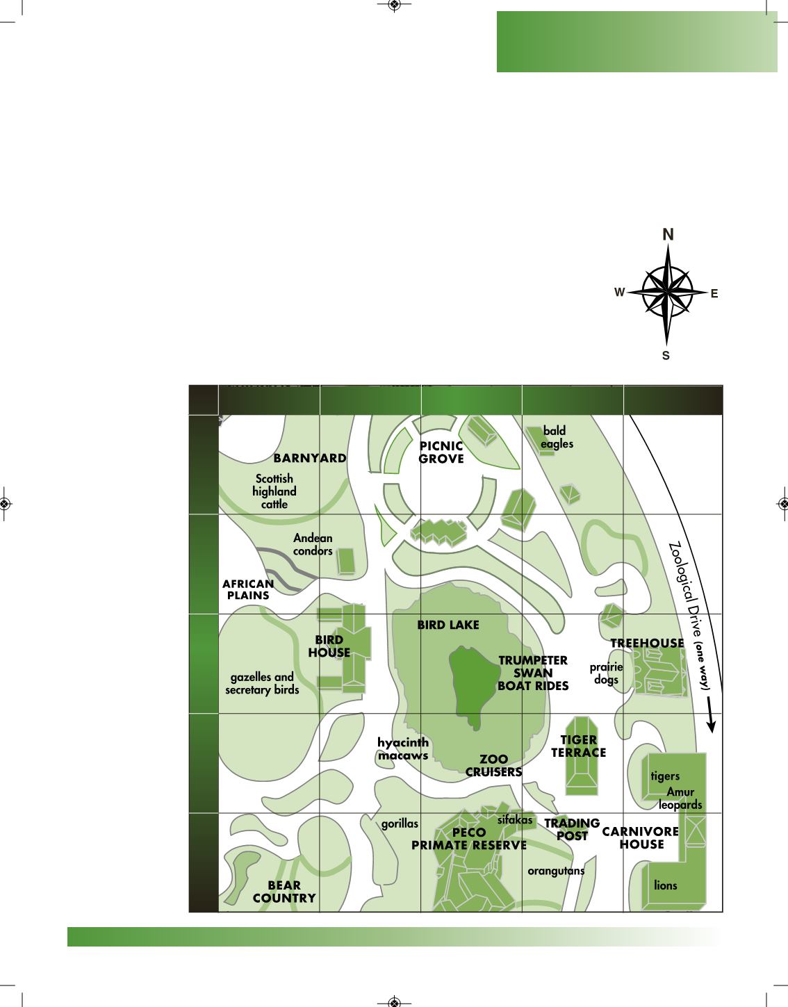
We can use
a map of the
Philadelphia Zoo
to show you how
grid coordinates
work. Use your
fingers to find
what is located at
coordinates C,5.
Move one finger
down the C col-
umn.Place anoth-
er finger on the 5
row. Move that
finger across the
5 row. When the
two fingers meet,
you should have
l oca t ed t he
PrimateReserve.
NW NE
SW SE
Geography Skills
A
B
C
D
E
1
2
3
4
5


