LESSON
2
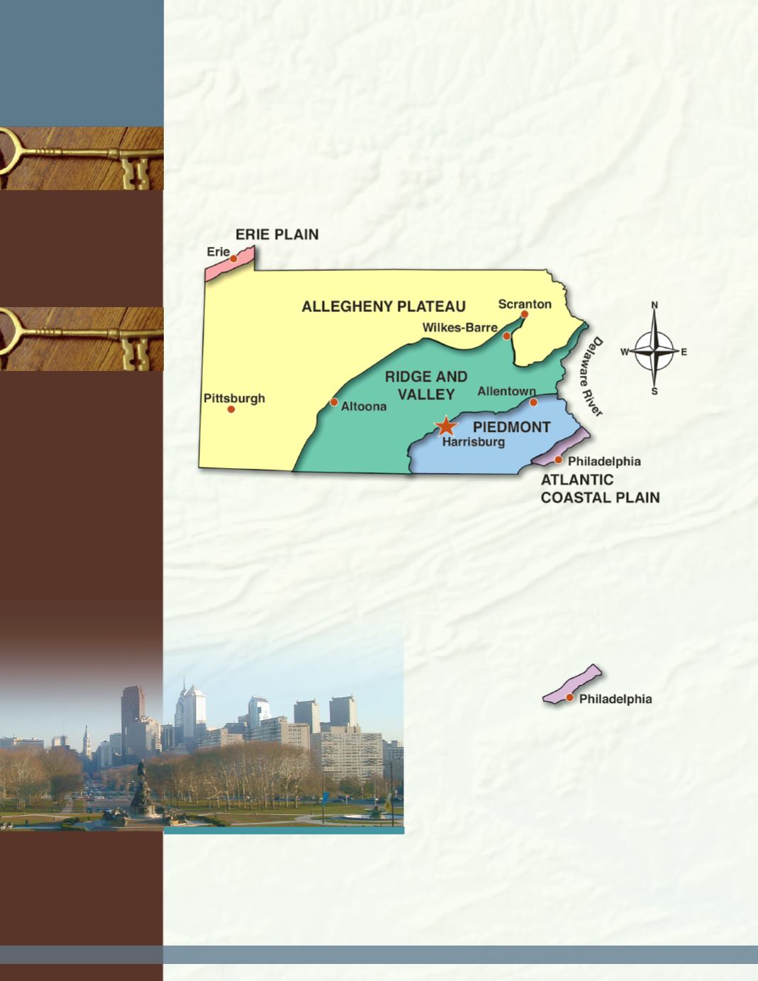
As you read about landforms and regions, look at the statemap of Pennsylvania to
help you better understand the places that are being described. Place a ruler at Erie and
run it southeast diagonally across our state to Philadelphia. The ruler travels across five
different geographic regions.
Regions
are areas that have at least one feature in
common. Each of the five regions has something in common regarding its landforms and
elevations.
Landforms
are plains, valleys, hills, mountains, and plateaus. As you read
about each region, look at the physical map of Pennsylvania on page v.
The Atlantic
Coastal Plain
The Atlantic Coastal Plain is an area of
low land, or
plain
, that travels along the
eastern coast of the United States fromNew
York to Florida. Scientists think that
thousands of years ago this land lay
underwater. Part of this level land reaches
about 10miles into the southeastern corner
of Pennsylvania. Here, the elevation ranges
from39 to 45 feet above sea level. The
deep water port of Philadelphia is located
here, as well as Upper Darby, Chester, and
Levittown. From this location, travel
northwest along the ruler. The land slowly
rises in elevation as it stretches into another
region–the Piedmont.
L
ANDFORMS AND
R
EGIONS
OF
P
ENNSYLVANIA
regions
landforms
plain
ridge
plateau
KEY
WORDS
KEY
PLACES
F
OCUS
Q
UESTIONS
:
1. What are the fivemajor landform regions of Pennsylvania?
2. What are somemain features of these regions?
Philadelphia, one of the largest cities in our
country, is in our state’s Atlantic Coastal
Plain region in the southeast corner of our
state. This city is on theDelaware River,
providing an easy route for trade through the
Delaware Bay to the Atlantic Ocean.
8
Understanding Pennsylvania
Appalachian
Mountains
Juniata River
Great Valley
Schuylkill River
Allegheny Mountains
Susquehanna River
PoconoMountains
Allegheny River
Laurel Highlands
Monongahela River
Ohio River
Mt. Davis
Lake Erie
Great Lakes


