LESSON
1
KEY
WORDS
KEY
PLACES
L
OCATIONAND
C
LIMATE
OF
P
ENNSYLVANIA
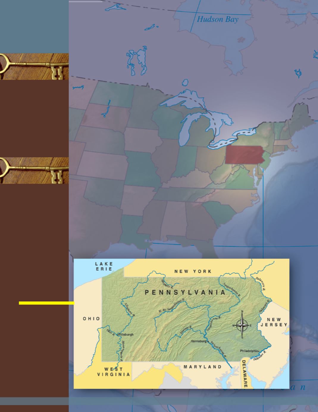
Location of Pennsylvania
Pennsylvania covers 46,055 squaremiles. A
square
mile
is determined by multiplying 1mile in width by 1
mile in length. In terms of land size, it is the 33rd largest
state in the United States. Our state is rectangular in
shape. It spansmore than 280miles in width and over
160miles in length.
The term
region
is used to locate states. Our state is
one of the southernmost states in the
Northeast Region
.
Pennsylvania is also part of the
Mid-Atlantic Region
. It is
bordered to the east by the
Delaware River
. This river
separates Pennsylvania from the states of New Jersey
and parts of New York. To the south, Delaware, Maryland,
andWest Virginia border Pennsylvania. Ohio and the
panhandle
of West Virginia border our state’s western
side. Much of New York rests upon Pennsylvania’s
northern border. A small part of
Lake Erie
, one of the
Great Lakes, also borders our state to its north.
Another way to locate a state is through latitude and
longitude. Fromsouth to north, Pennsylvania ranges from
39°N latitude to 42°N latitude. Fromeast to west, it
ranges from74°W longitude to 80°W longitude.
squaremile
region
panhandle
dispute
humid continental
nor’easter
drought
lake effect
Northeast Region
Mid-Atlantic Region
Delaware River
Lake Erie
Mason-Dixon line
F
OCUS
Q
UESTIONS
:
1. Where is Pennsylvania located in the United States?
2. How is theMason-Dixon line connected to Pennsylvania’s location?
3. What is Pennsylvania’s climate like?
Pennsylvania borders
six states: NewYork,
NewJersey,
Delaware,
Maryland,West
Virginia, andOhio.
The northwest corner
of our state is on
Lake Erie, while the
Delaware River
makes our entire
eastern border.
4
Understanding Pennsylvania


