What does the
Mason-Dixon Line
have to do with Pennsylvania’s
location? For many years, there was a border
dispute
between the
owners of the Pennsylvania, (and later Delaware), Maryland, and
Virginia colonies, specifically the Penns and the Calverts. When the
English king originally granted the charters for these colonies, he
provided confusing descriptions of the boundaries. As a result, feuding
and fighting erupted over many years. Finally, in 1763, two experts
fromEngland were brought to the region to accurately measure the
latitude (39° N) provided in the charters.
CharlesMason, an astronomer, and Jeremiah Dixon, a surveyor,
spent four years surveying the border using the stars. They had to
deal withmany hardships, such as hostile Native Americans, hostile
settlers, weather extremes, poor diet, illness, andmountains with no
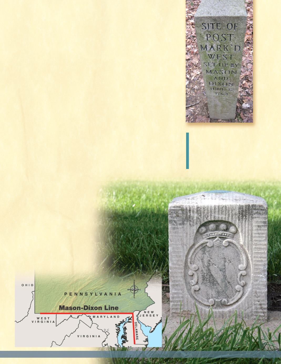
roads. Limestonemarkers weremined in England and brought to the
colonies and placed every mile of the 233mile border. The stones
ranged between 3.5 to 5 feet long and weighed between 300 to 600
pounds. At every 5thmile, larger stones had the Penn family’s coat-of-
arms engraved on the north side and the Calvert family’s coat-of-arms
on the south side.
While not its original intent,
theMason-Dixon Line became
the dividing line between the
Northern free states and the
Southern slave states during
the American Civil War. This
imaginary line is still used today
to differentiate between
northern and southern states.
C
HARLES
M
ASON
&
J
EREMIAH
D
IXON
TheMason-Dixon Line
A long-standing border dispute led to
the creation of theMason-Dixon
Line. Every fifth stone that marks
this border has the Calvert family
coat-of-arms facing south (shown
below), and the Penn family coat-of-
arms facing north.
Location and Climate of Pennsylvania
5


