PENNSVALLEY
88
COPYRIGHT
Lesson 44: (cont.)
Physical Features of Canada
Landforms
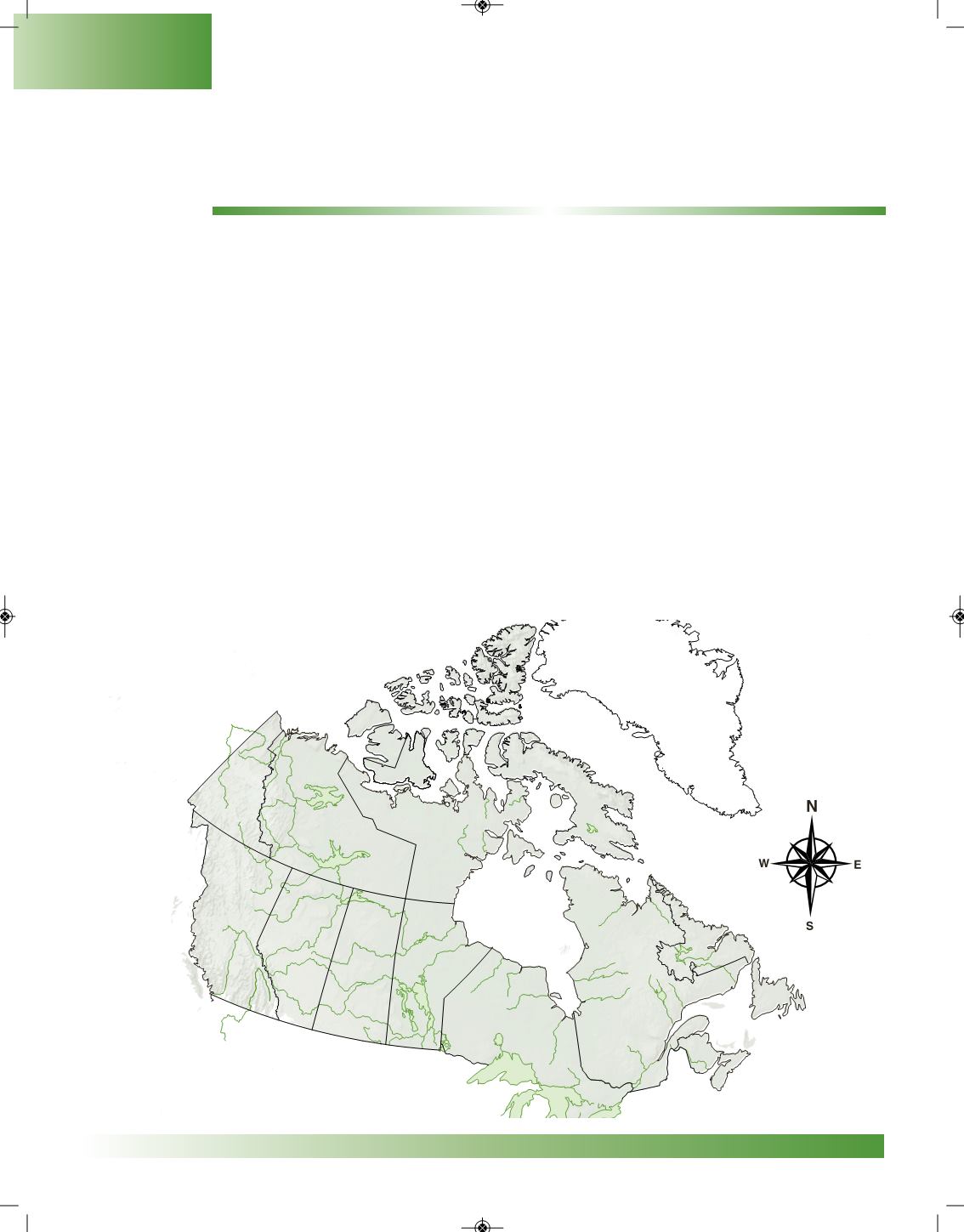
ACTIVITY 2:
Use the physical map of Canada on this page to label the
boldfaced
landforms below that cover
most of Canada. Use the physical map of Canada in your
Atlas Buddy (AB)
on page x to help you
locate them.
1. Locate the
AppalachianMountains
in eastern Canada, the
Rocky Mountains
in eastern British
Columbia, and the
Coast Mountains
inwesternBritishColumbia.
2. The
Canadian Shield
ismade up of very old rock. It covers almost one-half of Canada. This area
contains 25% of theworld’s freshwater supply.
3.Glaciers formed the
St. Lawrence Lowlands
.They cover much of southernQuebec and southern
Ontario around LakeOntario and theSt. LawrenceRiver.
4. The
Arctic Islands
(rememberwhat anarchipelago is?) are locatednorthof HudsonBayandnorth
of the newNunavut region.The coastlines are rugged, with cliffs and fiords.
5. The
Great Plains
, also called the Interior Plains, arewide areas of farmland that cover parts of the
provincesofManitoba, Saskatchewan, andAlberta.This region is called thebreadbasket of Canada
because of all the grain that is produced.
Canada
NW NE
SW SE


