COPYRIGHT
27
PENNSVALLEY
Lesson 18:
Remember the Big Facts
How canwe learn all this information?We have usedmaps, globes, charts, a crossword puzzle,
symbols, andgrid coordinates.Theseareall
visual tools
that havehelpedus learnabout theWestern
Hemisphere.
Sometimes it is helpful to place information that wewant to remember into another type of visual
tool, a
visual organizer
.Visual organizers help us remember big ideas that we read and discuss.
Let’s place the important informationonNorthAmerica intoa visual organizer.Wewill refer to this
visual organizer as a
definitionmap
.
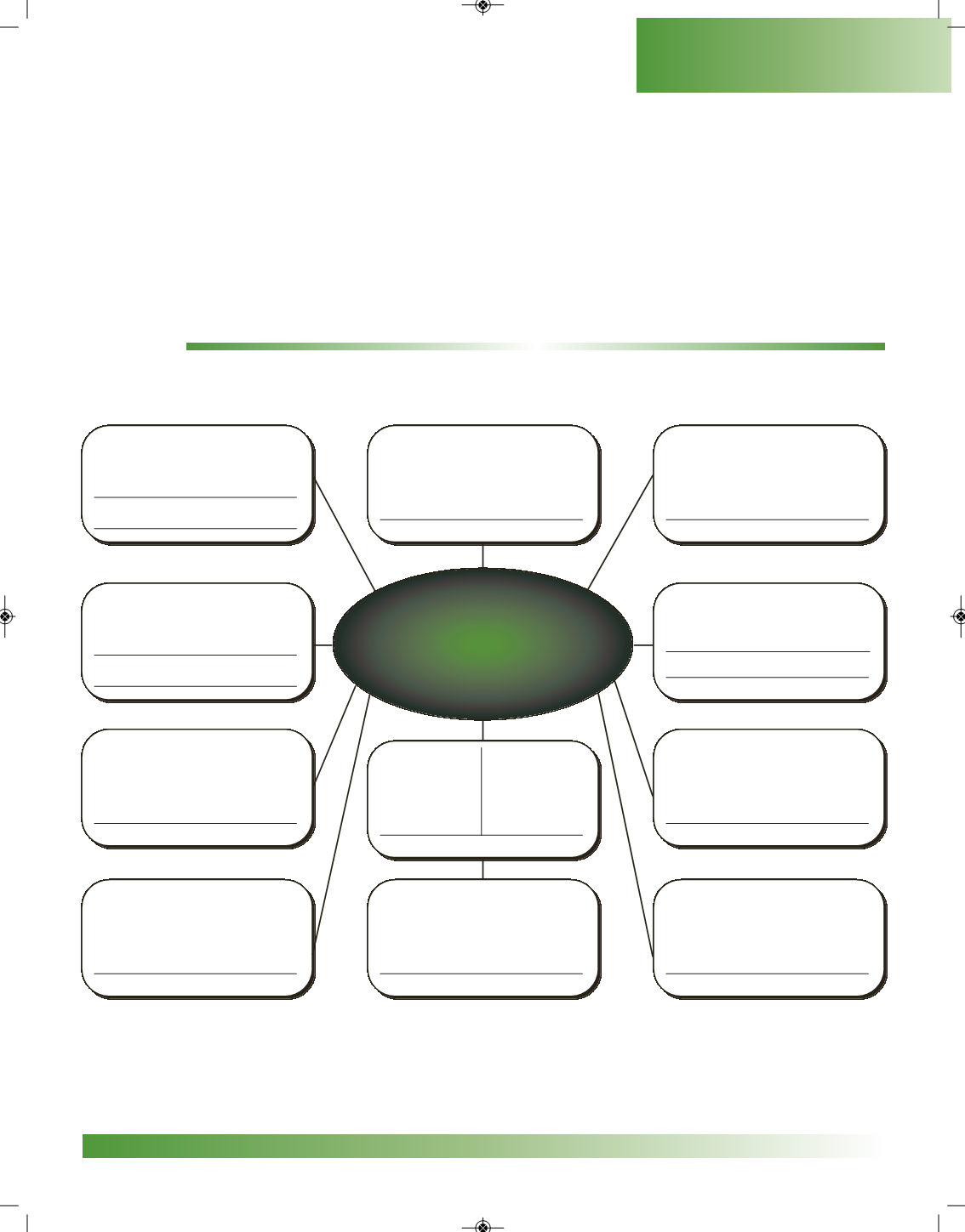
ACTIVITY:
SurroundingNorth America in the egg are phrases inwhich you are towrite answers. If needed, you
can look back in the reading to find this information about NorthAmerica.
place, and give
lowest elevation
country with largest
land area
country with largest
population
place, and give
highest elevation
North
America
oceans bordering
the continent
name of longest
river system
western border
landform
eastern border
landform
fraction of people
who live inU.S.
number of
people
land area size
number of countries
NorthAmerica
The center of your definitionmap is North America. Close your eyes and try to remember all the
important informationaboutNorthAmerica that youhave just organized. In the future,wewill useother
visual organizers to help us remember.


