COPYRIGHT
5
PENNSVALLEY
Geography Skills
Lesson 2
Review of Latitude and Longitude
Aswe review information about latitude and longitude, it would be desirable if you have a globe at
which to look. Remember, the imaginary lines that crisscross the earth are called latitude and
longitude. Latitude lines runwest and east, but measure distances north and south from theEquator.
Longitude lines run north and south, but measure distances east and west from the PrimeMeridian.
Let’s review locating places using latitude and longitude.
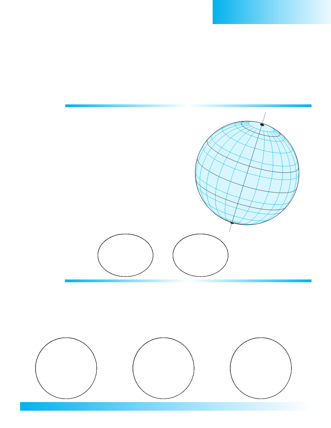
ACTIVITY 1:
A.Using the illustration of the globe, label
the followingmain lines of latitude.
Equator = 0°
23 1/2 °N =Tropic of Cancer
66 1/2 °N =ArcticCircle
90°N =NorthGeographic Pole
23 1/2 °S =Tropic of Capricorn
66 1/2 °S =Antarctic Circle
90°S =SouthGeographic Pole
B.Using the illustration of the globes, draw and
label the followingmain lines of longitude.
0° =PrimeMeridian
180° = International Date Line
ACTIVITY 2:
In the three small circles below, draw theneeded lines and label and color the following. (
Note
:Donot
forget that the earth is tilted on its axis by 23 1/2 °.)
1. For the LatitudeCircle =NorthernHemisphere andSouthernHemisphere
2. For the LongitudeCircle =WesternHemisphere andEasternHemisphere
3. For the ZoneCircle = tropical zone, temperate zone, polar zone
LatitudeCircle
LongitudeCircle
ZoneCircle
66-1/2
o
66-1/2
o
66-1/2
o
66-1/2
o
23-1/2
o
23-1/2
o
23-1/2
o
23-1/2
o
0
o
0
o


